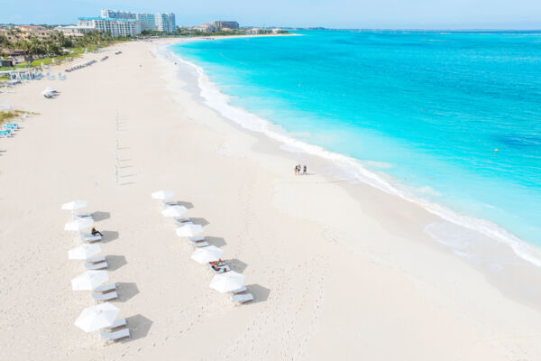
Turks and Caicos Hurricane Information
2025 Updates
Hurricane Melissa
Hurricane Melissa passed west of the Turks and Caicos on October 29, 2025. The storm did not cause any noteworthy damage to the country, and tropical storm conditions were milder than initially forecasted. For a detailed timeline of the storm, see Hurricane Melissa: Turks and Caicos Updates.
Hurricane Erin
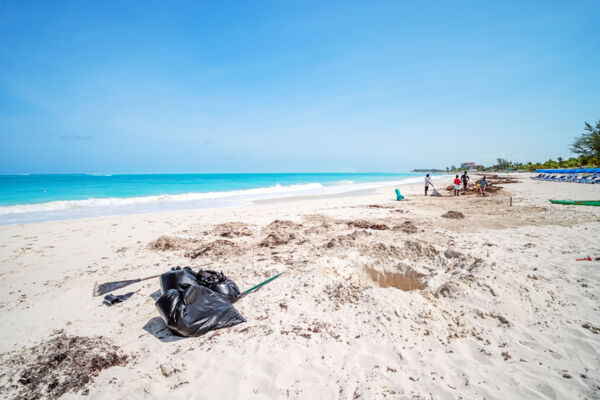
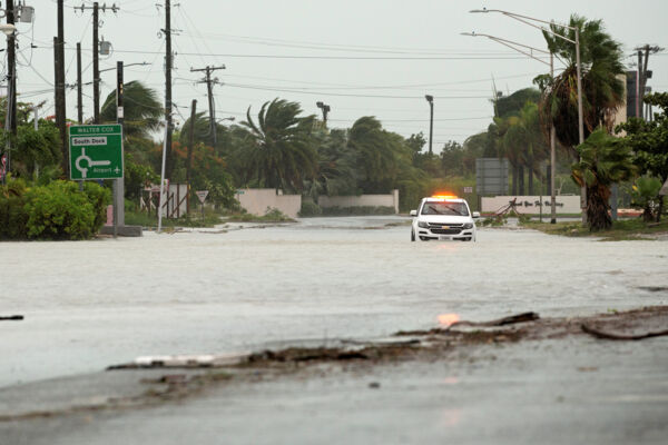
Hurricane Erin passed to the north of the Turks and Caicos during the early hours of August 18, 2025, causing minor tropical storm conditions. No significant damage or flooding occurred in the islands.
Moderate amounts of seaweed and sargassum were deposited on Grace Bay Beach during the storm. The beach has since been cleared.
2024 Updates
Hurricane Oscar
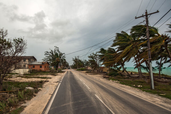
Hurricane Oscar, a unique and tiny hurricane that quickly developed from a disturbance over a matter of a few hours, struck the Turks and Caicos on October 19 and 20. The path of the storm traveled close to the islands of Grand Turk and Ambergris Cay. Very minor damage was caused in the Turks and Caicos, and the main island of Providenciales was not affected.
Hurricane Milton
Hurricane Milton did not affect the Turks and Caicos Islands.
Hurricane Helene
Hurricane Helene did not affect the Turks and Caicos Islands.
Hurricane Ernesto
Hurricane Ernesto did not affect the Turks and Caicos Islands.
Hurricane Beryl
Hurricane Beryl did not affect the Turks and Caicos Islands.
Past Storms
Hurricane Fiona, September 2022
Hurricane Fiona, which hit the country in September of 2022, caused limited damage.
The island of Providenciales experienced limited impact, mainly minor flooding. The eye of Hurricane Fiona passed near the eastern side of Grand Turk and Salt Cay, and the islands experienced more flooding and wind damage than what occurred on Providenciales. The central islands of North Caicos, Middle Caicos, and South Caicos were closer to the path of Hurricane Fiona than Providenciales, and consequently experienced greater flooding and wind speeds.
Hurricane Isaias, July 2020
In the very early morning hours of 31 July, Hurricane Isaias passed close to the southeast of the Turks and Caicos. However, the Turks and Caicos experienced very little impact beyond minor flooding and landscaping damage.
Hurricane Dorian, August 2020
The catastrophic category 5 Hurricane Dorian had no effect on the Turks and Caicos.
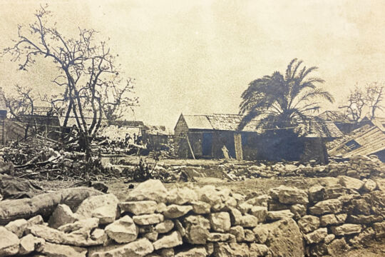
2017 Hurricane Irma and Hurricane Maria
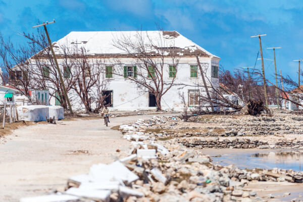
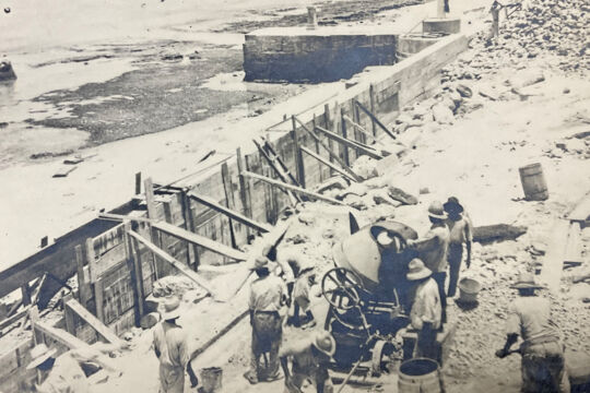
The Turks and Caicos Islands were hit by Hurricane Irma and Hurricane Maria in September 2017. Severe damage was suffered across the country, especially on the islands of South Caicos, Grand Turk, and Salt Cay. The islands have since fully recovered.
North Caicos, Middle Caicos, and Providenciales generally fared the best of the major islands, and the recovery and clean-up efforts progressed rapidly.
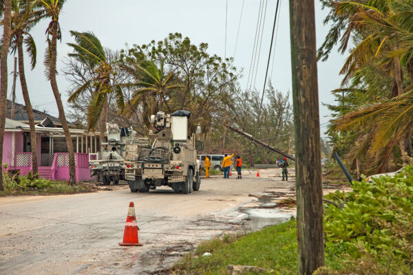
Hurricane Irma demolished structures and roofs across the Turks and Caicos, and downed almost 1300 utility poles. Pelican Energy TCI (formerly Fortis TCI), the primary electricity provider in the country, brought in over 200 experienced linesmen and staff, trucks, and equipment from Canada to facilitate the rebuilding of service, and power was restored to all eligible buildings in the country in November 2017.
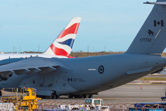
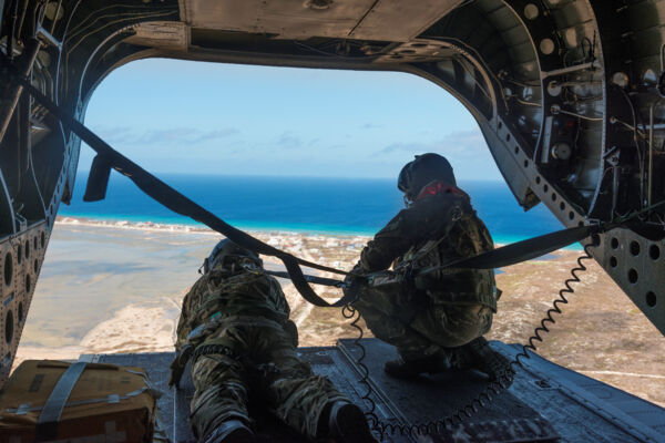
The British Armed Forces provided important aid in the initial days and weeks after the hurricanes struck, especially regarding the transport of essential supplies.

General and Historical Hurricane Information
As an archipelago in the tropical Atlantic (see Where is Turks and Caicos for location information), the Turks and Caicos Islands are at risk of being hit by a hurricane or tropical cyclone during the June to November Atlantic Hurricane Season.
Over the last few decades, the country has been extremely lucky, with the only extensive damage seen being that caused by the 2008 Hurricane Ike on Salt Cay and Grand Turk and the consecutive 2017 Hurricanes Irma and Maria on Grand Turk.
What is the Hurricane Season?
The hurricane season is the time of year when tropical cyclone weather events may be expected in the Atlantic, Caribbean, and Gulf of Mexico. The hurricane season is generally considered to start on June 1st, and end on November 30th. It’s possible for tropical cyclones and hurricanes to form outside of this period, yet it is very uncommon.
Tropical cyclones, which are expansive rotating storms with a low-pressure center, are usually referred to as tropical storms if the sustained wind speeds reach 39 to 73 mph (63-118 km/h), or hurricanes if the sustained wind speeds exceed 74 mph (119 km/h).
Hurricanes and Your Vacation
Obviously, a hurricane can put a serious damper on your visit to the islands. Generally, the summer hurricane season months experience beautiful (yet hot!) weather in Turks and Caicos, however, although unlikely, the risk of a storm hit does exist.
Our advice on whether to plan your vacation during the hurricane season hinges on the flexibility of your schedule.
There’s typically about a week’s warning of a possible storm hit. If you purchase an airline fare with waived ticket change fees or travel insurance that includes cancel for any reason (CFAR) coverage, and if your personal schedule allows for a possible vacation date change, chances are that you’ll have a great stay.
If a storm hit is imminent, airlines will often provide additional flights out of the country before the expected storm.
The local accommodations are usually amenable to rescheduling or refunding if a hurricane or tropical storm threatens the country, however, inquire about the policies before booking.
Partially due to the potential storms, tourism in the Turks and Caicos tends to slow down in the late summer and autumn months. A few resorts and restaurants will close during this period, however, the businesses that remain open will typically offer the lowest rates of the year at this time.
Hurricane Damage in the Turks and Caicos
Hurricanes wreak havoc through several factors, and simple high winds actually are typically not the most destructive element of the storm.
Although not a problem in the Turks and Caicos, in more mountainous regions, landslides, caused by heavy rains, account for the majority of tropical cyclone deaths. Likewise, in areas prone to storm surges, widespread flooding is the primary source of devastation.
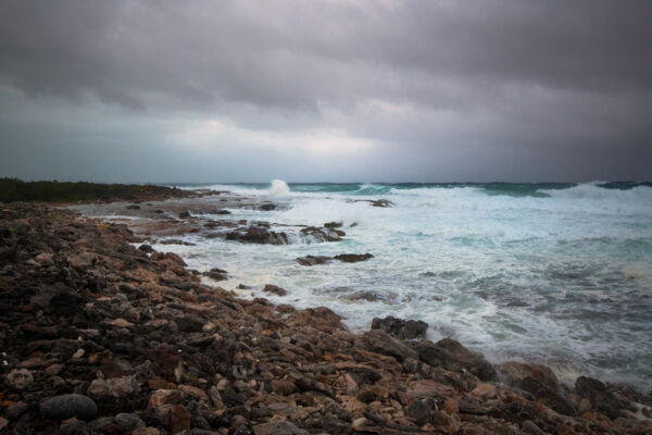
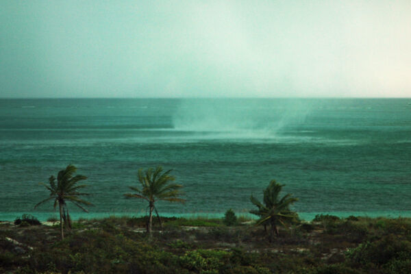
Storm Surge
Storm surges can have a tremendous impact on the Turks and Caicos.
Approximately half of the Turks and Caicos consists of low-elevation wetlands and saline flats, and significant amounts of the remaining land in the country is of very low elevation. In addition, almost every historical settlement in the Turks and Caicos is located near the ocean.
The storm tide (the combination of a storm surge and typical tide) in a major hurricane can reach heights of over twenty feet (6 meters), however, geography can greatly affect the surge height.
Storm surges are mainly created by wind, and not so much the reduction in atmospheric pressure as is occasionally stated. Regions surrounded by gently sloping and gradually decreasing ocean floor, such as the south-eastern United States, tend to experience a far higher surge than seen at some of the Caribbean islands.
Fortunately for us, the Turks and Caicos Islands are situated on an underwater plateau, and much of this plateau exhibits abrupt transitions between the Atlantic Ocean floor at around 11,000 (3.3 km) feet in depth, and the shallow 30-60 foot depths (9-18 meter) water on the plateau. Such terrain is not conducive to the extreme storm surges occasionally seen in other countries.
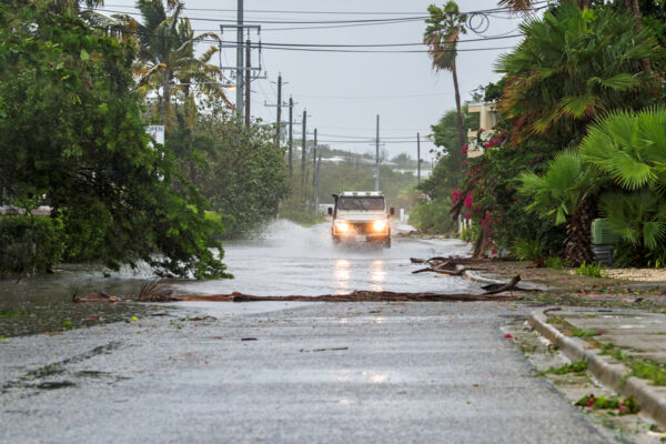
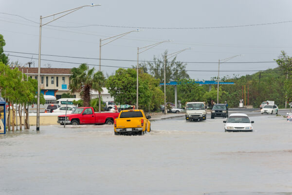
Roads in regions including Leeward, Five Cays, Turtle Tail, and the southwestern end of Providenciales, and much of the primary “town” areas on Grand Turk and South Caicos become submerged during almost any hurricane.
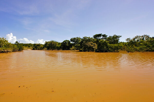
Rain and Flooding
The Turks and Caicos experiences very little annual rainfall, and unfortunately much of this occurs over only a few distinct tropical cyclones. Natural underground water lenses are replenished to a degree by such deluges, however, the ground becomes over-saturated with water and much is lost due to drainage to the ocean.
An unpleasant by-product of rainwater flooding are outbreaks in the local mosquito populations. 10-12 days after heavy rains, as if by clockwork, mosquitoes emerge. They tend to persist for a little more than a month unless strong breezes drive them away, or rainfall continues.
Our different islands tend to see varying amounts of mosquitoes. Salt Cay, Grand Turk, and to a slightly less degree, Providenciales, tend to see far less of the pests than North and Middle Caicos, East Caicos, Parrot Cay, and Pine Cay.
Utilities
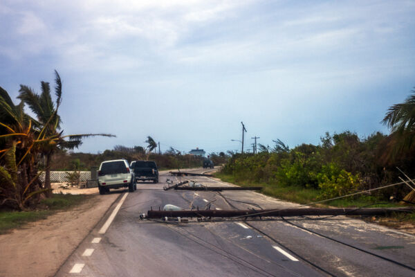
As to be expected, a major storm can cause extended damage to utilities, especially when power and communication lines are hung on wood utility poles, which is largely the case throughout the Turks and Caicos.
Providenciales has fared quite well over the last decade, with only relatively limited power outages. The island’s electricity provider, Pelican Energy TCI (formerly Fortis TCI), has performed an excellent job in maintaining and restoring power during and after storms.
The smaller islands in the country tend not to fare as well. The problems are not simply constrained to electricity. The potable water supply on Salt Cay, South Caicos, and Grand Turk is produced by reverse osmosis, and both damage to the filter systems and the lack of power prohibits the production of fresh water. Salt Cay in particular experienced such shortages for quite some time after the widespread destruction of Hurricane Ike in 2008.
Good condition wood utility poles, when set in the typical limestone bedding common to the Turks and Caicos, are quite resistant to storms. However, as seen in the case of Blue Hills and the 2008 Hurricane Hanna, aged poles in sandy ground do not hold well.
Vegetation and Coastal Areas
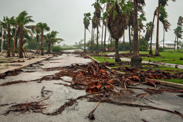
Landscaping and trees will of course see quite a bit of damage. The average soil depth in the islands is quite shallow, with an underlying limestone bedding. Many local trees, although not particularly tall in general, will often simply fall over.
An interesting effect is salt-burned vegetation. After a hurricane or large tropical storm, the side of the islands that bore the brunt of the storm will often exhibit greenery loss due to wind ocean spray. For hundreds of feet inland, leaves will become shades of browns and reds, not unlike the autumn colors seen in temperate zones. It can take months for the trees and plants to recover and regrow the foliage.
Sand erosion and movement also take place. Although only reaching tropical storm level winds on Providenciales and West Caicos, the recent 2015 Hurricane Joaquin eroded much of Malcolm’s Road Beach, much of the sand from which ended up along the Northwest Point coast. One of the better-remembered instances of sand movement occurred during the major category 4 Hurricane Donna, which opened Donna Cut, a channel that once existed at Half Moon Bay between Little Water Cay (Iguana Island) and Water Cay. This waterway gradually filled back in, completely closing off in 1999.
Historic and Recent Hurricanes
Statistics show that September is the most likely month of the year in the Turks and Caicos for hurricane landfall.
2016 Hurricane Matthew
Fortunately, the Turks and Caicos was spared any damage from the October 2016 Hurricane Matthew. Average wind speeds did not exceed 40 mph (64 km/h), and experienced rainfall was quite light.
2015 Hurricane Joaquin
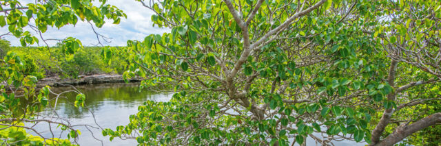
This hurricane only reached tropical storm intensity in the Turks and Caicos and caused very little actual destruction to property. The largely-undeveloped west coast of Providenciales, including the scenic Frenchman’s Creek Nature Reserve, Malcolm’s Road Beach, and Northwest Point Marine National Park, saw quite a bit of wave and storm surge damage, more so in fact than any other recent storm had brought about.
2008 Hurricane Ike
Close on the heels of Hurricane Hanna, this category 4 storm was the worst experienced in the country since Hurricane Donna in 1960. Salt Cay and Grand Turk saw far more extensive destruction than what took place in the Caicos Islands. The majority of residences on Salt Cay were either heavily damaged or destroyed.
2008 Hurricane Hanna
This storm’s path made a loop and passed twice quite close to Providenciales. With some help from Hurricane Ike, which passed only days later, Hurricane Hanna largely destroyed the newly-constructed North and Middle Caicos Causeway.
2004 Hurricane Frances
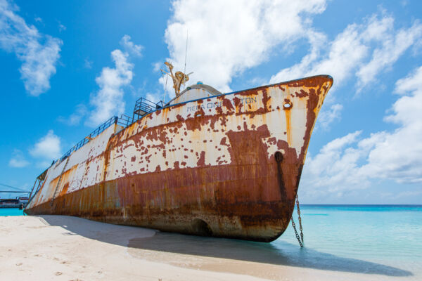
Hurricane Frances brought heavy rainfall, yet fortunately little more than landscaping damage. The famous La Famille Express shipwreck was grounded during this storm.
1985 Hurricane Kate
Striking on the 18th of November, 1985, Hurricane Kate’s path traveled directly through the Turks and Caicos.
Although only barely reaching category one status in the Turks and Caicos, this storm brought significant rainfall and flooding, sunk several boats, and damaged buildings.
1960 Hurricane Donna
One of the most powerful hurricanes to strike the Turks and Caicos in centuries, this coast-changing storm caused widespread destruction, yet amazingly did not claim any lives.
A significant storm surge, likely one of the highest seen in centuries, isolated many communities in the country for weeks.
Largely due to the storm surge and tremendous water movement, new channels were opened at quite a few locations, including at Bottle Creek and at Half Moon Bay between Little Water Cay and Water Cay. Many of the southern limestone coastlines saw the movement and piling of huge boulders.
1928 Great Okeechobee Hurricane
This terrible hurricane landed in the Turks and Caicos as a category 4 storm with sustained winds of up to 155 miles per hour (249 km/h), previously having hit Puerto Rico as a Category 5 storm. One of the lowest barometric pressures recorded in the mainland United States was taken after this expansive storm made landfall in Florida.
Several ships were lost in the Turks and Caicos during this hurricane.
An indicator of increasing technology and the changing times, the United States Weather Bureau in Washington D.C. sent a warning of the approaching tempest.
1926 Hurricanes
Two major storms passed within months of each other, one on the 24th of July and another on the 16th of September. Both storms reached category 4 and caused extensive damage to the nation's salt industry, plantations, and vessels.
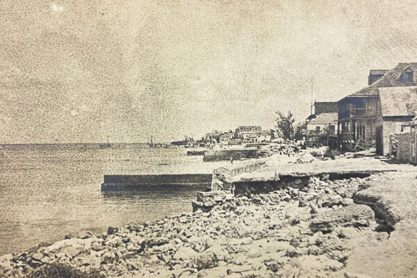
1866 Great Nassau Hurricane
Striking on the 30th of September, this tremendous hurricane is probably the most destructive recorded to have hit the Turks and Caicos. About three-quarters of the country’s population was left homeless and with no possessions, and the economic impact lasted for decades. At least 50 lives were lost in the country.
The Great Nassau Hurricane hit with little warning, yet it did so during the day. If it had struck at night, the resulting deaths would likely have been in the hundreds.
All of the industries in the country, including fishing, sea salt production, and the cotton and sisal plantations, were devastated. One and a quarter million bushels of sea salt, all of it raked by hand, was lost.
1813 Great August Hurricane
Striking on the 22nd of August, this major yet compact storm demolished hundreds of buildings, the majority of crops on the Caicos plantations, and sunk many vessels. Half a million bushels of collected sea salt, ready for export, was washed away. This storm continued on to cause many drowning deaths in South Carolina.