The North and Middle Caicos Causeway North and Middle Caicos

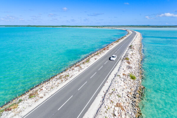
Located in the shallow southeastern end of Bottle Creek Lagoon, the North and Middle Caicos Causeway is a 1-mile-long (1.6 km) two-lane road that connects the islands of North Caicos and Middle Caicos. The road is a limestone quarry-fill embankment roadway, with two small concrete bridges and many corrugated HDPE pipe culverts that allow for natural tidal movement.
There is no toll to access the causeway.
Current Condition
The North and Middle Caicos causeway is currently in fair condition and can be traversed by virtually any of the available rental cars on the islands.
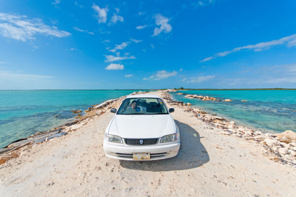
The causeway suffered serious hurricane damage during Hurricane Ike and Hurricane Hanna in 2008, after which it was completely repaved. Since then, subsequent storms have washed away sections of the asphalt on the causeway, and barriers have been installed on either side of the road.
While the causeway is generally safe for traffic, care should still be taken when driving across it (as there are potholes and rough transitions between unpaved sections and asphalt).
History

Before the construction of the causeway in 2007, the only link between North Caicos and Middle Caicos was by small boat. Needless to say, this wasn’t acceptable for two large islands separated only by a shallow channel.
The financing for the causeway project came from the European Union’s 9th European Development Fund (EDF9).
When it was initially completed, the causeway was paved with asphalt, had concrete side walls, and was equipped with full street lighting. However, these features proved to be short-lived, as Hurricane Hanna passed twice over the Turks and Caicos over a matter of days in 2008, causing extensive damage to the causeway.
Nearly all of the asphalt paving was washed off in sheets, the concrete barriers collapsed, and much of the street lighting and utilities simply disappeared. Large amounts of rebar were exposed, as was the ground barrier sheeting.
The bulk of the rock and crushed limestone embankment remained—however, the width at high tide barely allowed for a vehicle to pass. The condition persisted with only minor repairs until 2014, when a major refurbishment project began.
