The Turks and Caicos Barrier Reef
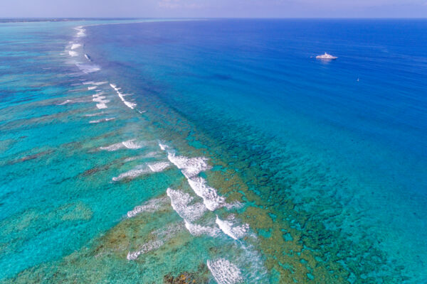
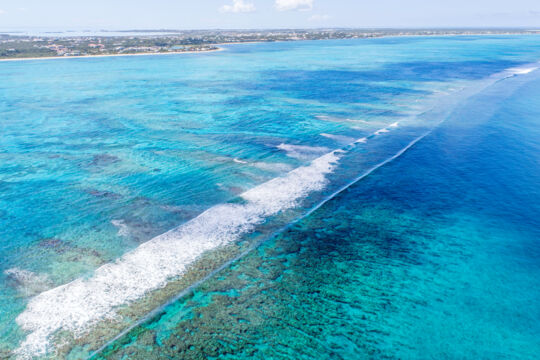
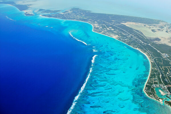
The Turks and Caicos is home to one of the best barrier reefs in the world, and probably the second finest reef system in the tropical Atlantic (after the Mesoamerican Barrier Reef System off the Yucatan and Belize).
Collectively, there are approximately 340 miles (547 km) of barrier reef surrounding the Turks and Caicos, with about 240 miles (386 km) of it bordering the Caicos Islands archipelago and Caicos Banks, and about 100 miles (160 km) of the system encompassing the Turks Islands chain.
The barrier reef system defines the environment of the Turks and Caicos, accounts for our spectacular beaches, and is hence critical to the luxury tourism-driven economy and the general well-being of the country. The healthy reef system directly leads to ongoing and proficient sand creation, and consequently the amazing white sand beaches found on nearly all islands in the country.
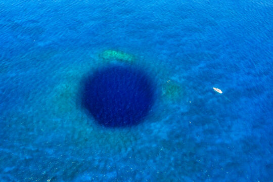
By total landmass, the Turks and Caicos is one of the world’s smallest countries, yet is home to several remarkable natural features. In addition to the exceptional barrier reef system, the widest blue hole in the world, the Middle Caicos Ocean Hole, and the largest dry cave system in the Lucayan Archipelago, Conch Bar Caves, are both located here. East Caicos, located centrally in the Caicos Islands archipelago, is also one of the largest uninhabited islands in the tropical Atlantic.
Marine Wildlife and Biodiversity
The Turks and Caicos supports an incredible range of marine life, nearly all of which is either found on or is supported by the reefs in the country. The extensive wetlands of the Caicos Islands are an important counterpart to the reef systems, and serve as nurseries for many species that are found on the reefs offshore.
Many of the tropical Atlantic water species are represented on or around the Turks and Caicos Barrier Reef. Particularly, the reef system excels in the general diversity of species, and supports large densities of stoplight parrot fish, Caribbean reef sharks, and a plethora of hard and soft coral species.
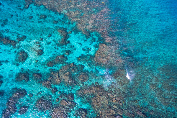
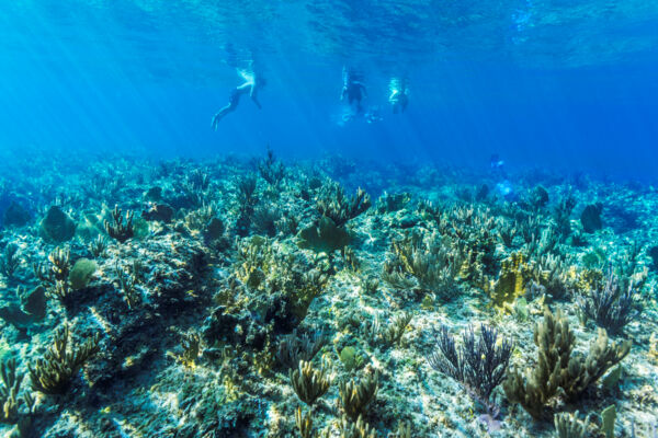
The underwater terrain of the barrier reef varies quite a bit depending on the location. Many areas have a transition from the interior and sandy ocean floor, to shallow sea fan beds or patches of elkhorn coral, which then descends to spur and groove formation reefs, and then the wall and great depths off the underwater plateau.
The sea fan and elkhorn coral terrains are exquisite snorkeling settings, with high densities of yellow and purple sea fans, gullies, arches, and small caves, and vibrant corals. Wrasse, parrotfish, triggerfish, jacks, blue tangs, black durgons, chub fish, and angelfish are common in these zones.
The Turks and Caicos supports a healthy array of predators. Caribbean reef sharks and nurse sharks are the most common sharks on and near the barrier reef. Barracudas, southern brown stingrays, and eagle rays are also regularly seen. Other types of sharks, including tiger sharks, bull sharks, and hammerheads, are found in the waters, yet are a bit more unusual.
The Wall
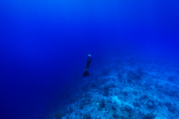
The Turks and Caicos enjoys a reputation as a top-tier scuba diving destination, and attracts divers from around the world. In addition to the vibrant corals and marine life, a defining feature of our underwater sights is The Wall, which is the common moniker for the abrupt transition between the shallow water and reef on top of the Turks and Caicos subterranean plateaus and the very great depths directly off it. In many locations, this transition is nearly vertical, which led to the term The Wall.
Some of the best wall dive sites in the country are found off of Northwest Point on Providenciales, near West Caicos and French Cay, and off of Grand Turk and Salt Cay. On days with exceptional visibility, the underwater view is awe-inspiring.
Dive Sites
Popular and incredible dive sites are found across much of the Turks and Caicos Barrier Reef. Near Providenciales, such sites span nearly the entire western half of the Caicos archipelago, as well as many dive sites near South Caicos on the eastern side of the island chain.
In the Turks Islands group, both Grand Turk and Salt Cay are surrounded by excellent dive sites.
Grace Bay Snorkeling Sites
One of the most frequently-visited barrier reef locations in the Turks and Caicos are the snorkeling sites that surround Leeward Cut off the northeast side of Providenciales. On good days there are typically many tour boats moored in the area. The area combines beautiful sea fan beds with pronounced cave and gully formations, with ease of access from the island.
Northwest Point and West Caicos
The Turks and Caicos typically experiences an eastern trade wind, and as such the lee of the islands is typically off the west coast. Because of this, some of the most popular dive sites near Providenciales are those in the Northwest Point Marine National Park off of Providenciales and the West Caicos Marine National Park, where the waters are usually calm with great visibility.
French Cay
The remote and tiny nature sanctuary of French Cay is also a popular dive location, and many sites are found here. This region is one of the best areas to see sharks in the Turks and Caicos.
Sand Bore Channel
Sand Bore Channel is one of the finest dive sites in the country, yet unfortunately, requires better weather conditions than other sites to be viable for diving. This channel is located on the western edge of the islands between Providenciales and West Caicos, and excels due to its general diversity and density of marine life.
West Sand Spit
West Sand Spit is another remarkable location on the barrier reef, and is a very remote sandbar on the central south side of the Caicos Islands plateau. This site is essentially the termination point of the extensive sand shoals and shallows that lead off the west side of Little Ambergris Cay, and is located nine miles (14.5 km) from the nature sanctuary island of French Cay. The location offers great diving and an impressive and rapid transition between the sandbars and the great depth off the wall.
Shipwrecks
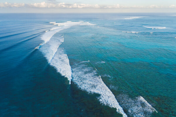
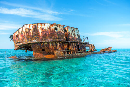
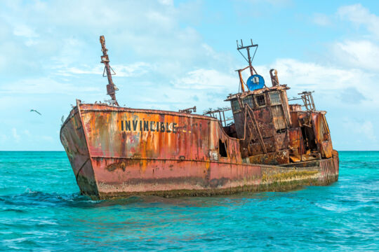
By area, the Turks and Caicos Barrier Reef is historically one of the most dangerous regions for ocean going vessels in the world, and it’s estimated that the relatively small expanse of the archipelago has seen more than a thousand shipwrecks over the last few centuries.
Some of the more treacherous locations on the reef system, including False Cut and the West Reefs near Providenciales, Haulover Point, Lorimer’s Point, Phillips Reef, and Drum Point near East Caicos and Middle Caicos, and North Reef near Grand Turk, saw higher densities of shipwrecks.
In fact, the Turks and Caicos saw so many wrecks, that it lead to a cottage industry of ship salvaging, known as wrecking. Wrecking became a significant part of the economy of the poorer Caicos Islands, and in fact reached a point where malicious activities with lights were likely practiced in order to deceive vessels into wrecking, much like what had occurred on the Outer Banks in the Carolinas on occasion in the past. To sum up the situation, the American Consul at the time accused the islands of carrying on a system akin to piracy, and one captain urged fellow seafarers to “use the utmost caution to avoid being deceived by any lights that may be shown from the Caicos Islands”. Birch’s Lookout near Northwest Point on Providenciales was one of the better-known wrecking bases.
Later on, wrecking became more controlled, and salvaged goods were auctioned off, with the proceeds being split between the wreckers and the ship or cargo’s original owners.
The Molasses Reef Wreck
One of the most historically important shipwrecks in the Turks and Caicos is the unique Molasses Reef Wreck, which is the oldest excavated European vessel site in the Americas. Initially thought to be Christopher Columbus’s Pinta, the exact origins of this very early 1500s caravel are still unknown.
The most likely theory is that this was a special expedition ship that was outfitted by investors to profit off of the newly-discovered lands of the New World. This vessel was grounded on a shallow section of the barrier reef between French Cay and West Caicos. The caravel carried an impressive and varied arsenal, and artifacts from the wreck can be seen today at the National Museum in Grand Turk.
H.M.S Endymion
The Turks and Caicos has seen many historic wrecks, yet only one is a recreational dive site, and even as such rarely sees visitors due to its remote location. The H.M.S Endymion was a 44-gun Roebuck-class fifth-rate frigate, built in 1779, and wrecked in 1790 south of Salt Cay. Today, the anchor and chains are the most prominent features to be seen.
The Trouvadore
Another important wreck that had a significant impact on the country was the Trouvadore. This ship was a Spanish slave ship that was destined for Cuba in 1841, yet wrecked off of East Caicos. Due to the British 1833 Slave Emancipation Act, all of the former slaves were liberated and many of the survivors remained in the Turks and Caicos, and were ancestors of the local population.
The Esperanza
The Esperanza had much of the same origin as the Trouvadore and was headed to Cuba with slaves. This ship sank in 1837 off of Middle Caicos or East Caicos. Unlike the Trouvadore, many lives were lost in the wreck, and the survivors were freed in Nassau in the Bahamas.
R.M.S Medina
One wreck that had wide-reaching effects was the R.M.S Medina, which was the first British Royal Mail Service ship to be lost at sea. This ship wrecked at North Reef off of Grand Turk, and was largely the catalyst for the construction of the Grand Turk Lighthouse.
The US Navy Gunboats
Another unusual situation was the loss of two unique US Navy gunboats at False Cut at Northwest Point, in completely unrelated events. Both vessels were on anti-piracy patrols, and sunk without loss of life.
The U.S.S Chippewa was a brig that was commissioned in 1815 to combat Barbary pirates and slavers in the Mediterranean (a decade after the US Navy was re-established for much of the same reasons). In 1816, the brig sailed to the Caribbean to join another navy frigate on patrol, yet hit the barrier reef at False Cut near Northwest Point on Providenciales. The site of the Chippewa has since been discovered, largely due to the ship’s unique armament of carronades.
The U.S.S. Onkahye schooner had an unorthodox racing yacht design, and again was to hunt for pirates in the Caribbean. It struck the reef at False Cut off Northwest Point in 1848, in much the same way as the Chippewa.
The Saxon
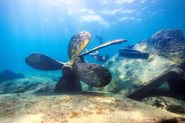
Another wreck, although perhaps not as historically important as the previously mentioned wrecks yet still interesting, was the English steamship Saxon, which wrecked near West Caicos in 1886. The captain, the mate, and the steward died when the ship broke apart, and the captain was buried on the dunes on West Caicos. Wrought ironwork and the anchor from the vessel can still be seen today.
Conservation of the Turks and Caicos Barrier Reef
Protection and uses of the reefs of the Turks and Caicos are continually under contention in the Turks and Caicos, by local environmental and tourism entities, the local fishing industry, and outside groups seeking to facilitate practices such as long-line fishing.
Turks and Caicos Reef Fund is the leading non-profit and non-government conservation organization tasked with the preservation of the marine environment in the Turks and Caicos. They strive to protect and facilitate low-impact tourism use of the reefs in the Turks and Caicos. Their projects have included the installation of moorings at popular dive and snorkel sites, education outreach, and the eradication of invasive species.
The Turks and Caicos government organization that oversees the reefs, fishing practices, and protected areas is the Department of Environment and Coastal Resources (DECR). Much of the entity’s efforts go into commercial and recreational licensing, as well as enforcing the fishing seasons and minimum keep sizes for conch, lobster, groupers, snappers, and bonefish.
Poaching, primarily by commercial fishermen from the Dominican Republic, is one threat to the reefs and marine life in the Turks and Caicos. Some vessels caught well within the country’s territorial waters were found to have thousands of pounds of illegal catch, representing the entire spectrum of fish typical to the reef, including hundreds of parrotfish.
Overfishing is a tremendous concern with many environmental groups in the Turks and Caicos, primarily for conch, as populations of this giant marine snail have declined significantly in the last few decades.
Other major concerns to the well-being of the reef systems include landscaping and sewage runoff from resorts, which is thought to be damaging the reefs in the Grace Bay area, and particularly the Bight Reef beach snorkeling site. The resulting eutrophication typically has long-lasting and significant impacts on the entire reef ecosystem.
As time goes on, more local tour operators in the Turks and Caicos are recognizing the threats to the marine environment, and are changing practices. Local charter companies such as the Big Blue Collective have pioneered the change, encouraging the use of reef-safe sunscreens and low-impact encounters with wildlife.
Protected Areas
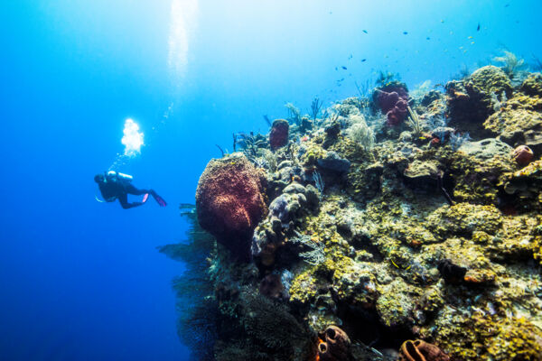
Several sections of the barrier reef in the Turks and Caicos fall under protected national parks or nature reserves.
The Princess Alexandra National Park includes much of the barrier reef system off the north coast of Providenciales, as well as the world-famous Grace Bay Beach, and the nature reserve islands of Little Water Cay and Mangrove Cay.
The Northwest Point Marine National Park protects about 10 miles (16 km) of barrier reef on the western side of Providenciales.
The West Caicos Marine National Park, as the name suggests, is located off of West Caicos, and includes some of the best dive and snorkel sites in the country.
Another gem in the Turks and Caicos is the Admiral Cockburn Land and Sea National Park near South Caicos. This area protects many exquisite dive sites and the beautiful island of Long Cay.
The Columbus Landfall National Park is located on the west side of Grand Turk, and includes the island’s best beaches and a significant range of reef and wall offshore.

